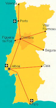
How to reach Figueira da Foz by
From North or South -
On highway A1, take the way out to Coimbra/Figueira da Foz. Then, use national road 111 to Montemor-o-Velho and the IP3 to Figueira da Foz.
From Vilar Formoso (border Portugal/Spain) -
Take road IP5 towards Aveiro. Near Aveiro take highway A1 direction of Lisbon. On highway A1, take the way out to Coimbra/Figueira da Foz. Then, use national road 111 to Montemor-o-Velho and the IP3 to Figueira da Foz.
See the web page of the portuguese railways
We advise you to go to Figueira da Foz via Coimbra.
Here you can find the train time tables for
Lisbon-Coimbra, Coimbra-Figueira da Foz and return
in html, postscript, pdf
Figueira da Foz
40º09’N 8º52’W
Tides
Reference port Lisbon
Mean time differences
HW:-10minutes +-10; LW:+15 minutes +-5Heights in metres
MHWS MHWN MLWN MLWS 3.5 2.7 1.3 0.5
Charts Approach Harbour Admiralty 3634, 3635 3253 Portuguese 2, 22, 34 64 Spanish 42A French 7277 Lights
Approach2060 Cabo Mondego 40º11’.4N 8º54’.2W
Fl.s5s101m28M Horn 30s
White square tower and building 15m
0957 Radiobeacon MD 287.5 kHz 150M seq 1,2
0958 Monte Real aerobeacon 39º54’.5N 8º52.9’W MTL 336 kHz150M
2062 Buarcos 40º09’.9N 8º52’.4W Isso.WRG.6s11m9/6/5M 004º-G-028-W-048º-R-086º Round tower, red and white bands 7m
2072 Penedo da Saudade 39º45’.8N 9º01’.8W Fl(2)15s54m30M
Square masonry towrer and building 32mHarbour
2069 Ldg Lts on 081.5º Front 40º08’.7N 8º51’.2W Iso.R.5sm8M White column, red stripes 3m
2066 North breakwater 40º08’.8N8º52’.4W Fl.R.6s14m9Mhorn 35s
Red tower, white band 7m
2068 South breakwater 40º08’.7N8º52’.3W Fl.G.6s13m7M Green tower, white band 7m, 15m from molehead
2069.4 North inner mole (Retanção Marginal) 40º09’N8º52’WFl.R.3s9m4M
Red truncated tower, white band 4m
2069.5 South inner mole (Retanção Marginal) 40º08’.8N 8º52’W Fl.G.3s8m4M
Green truncated tower, white band 4m
2069.6 Doca de Figueira, west mole 40º08’.9N 8º51’.5W F.R.6m2M Red column 3m
2069.7 Doca de Figueira, east mole 40º08’.9N 8º51’.4W F.G.6m2M Green column 3m
2069.8 Confluência 40º08’.8N 8º51’.3W Fl(3)G.8s7m4M
Green truncated tower, red band 4mPort radio
Postradfoz VHF Ch 16, 11 (Ch 16 Mon-Fri 0900-1200, 1400-1700LT). 2182, 2484, 2657 kHz (2182 kHz on request to Postradleixões Mon-Fri)
Pilots Pilotosfigueira VHF Ch 16, 14. (Mon-Fri 0900-1200, 1400-1700LT).
General
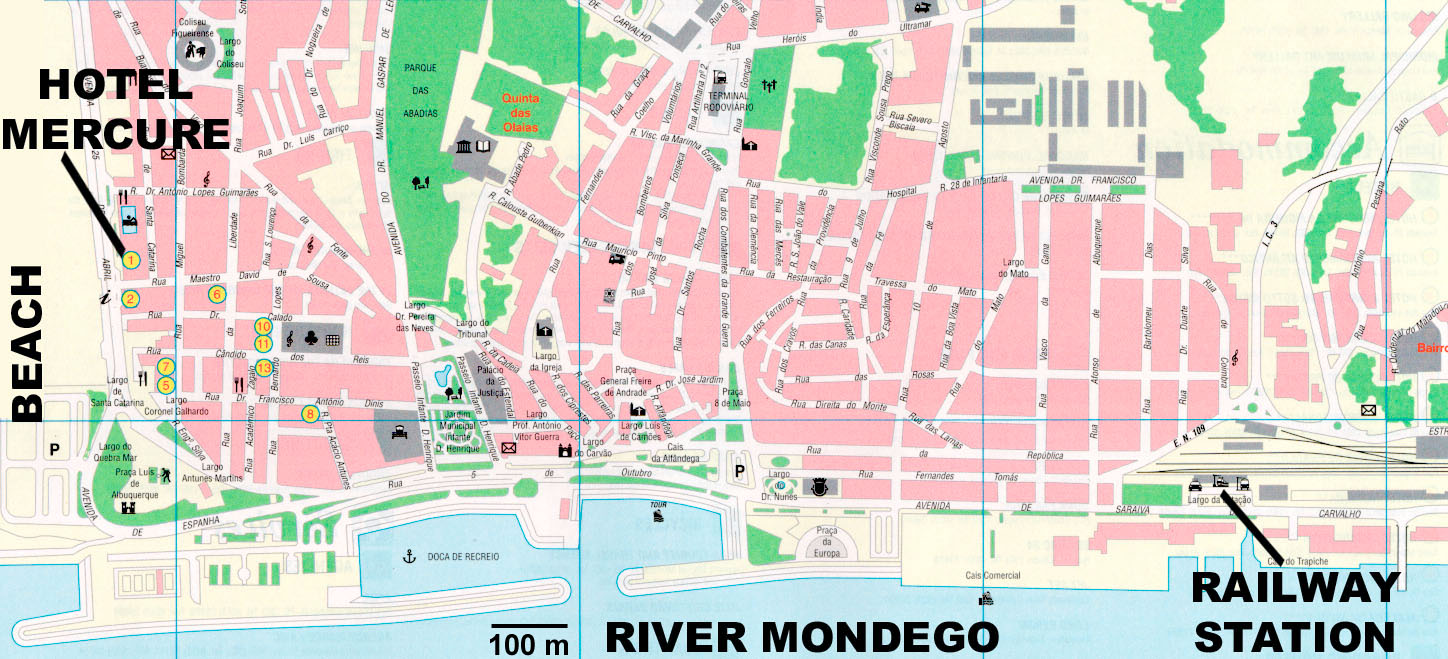
Figueira da Foz is on the north bank of the longest river to rise in Portugal. Although a modern town with good facilities depending largely on shipbuilding and tourism for its income, a large part of the attractive old town remains. The city of Coimbra, 45Km (28 miles) away is worth visiting by bus or train – the university, transferred there from Lisbon in 1320, has been disfigured by modern faculty blocks but is surrounded by the old city.
A well sheltered marina, which on completion will take 250 yachts, is taking shape in the Doca de Recreio.Approach
Figueira da Foz lies 2.5 miles south of cabo Mondego 2060 which at a distance, from both north and south, can be mistaken for na island. The shore to the south of the town forms a continuous low sandy beach backed by one of the largest coniferous forests of Europe. The major mark to the south is Penedo da Saudade 2072, 25 miles distant.
A white suspension bridge 1.5 miles upriver from the entrance is conspicuous offshore.Entrance
Dredging of the bar to 5 metres has greatly improved the entrance, though care is still needed. Danger signals are displayed if necessary from Forte de Santa Catarina (on the north side of the entrance) as follows: black ball or vertical green, red, green lights – entrance closed; black ball at halfmast or vertical grren, flashing red, green lights – entrance dangerous. These signals are mandatory and instructions may also be given by radio. If no signals are displayed the entrance is considered to ba safe.
The spring ebb can run up 7 knots though this rate is unlikely to be reached in the dry months. Depth inside the channel is 4.5 metres, decreasing to 2.5-3.5 metres in the yacht basin.
Berthing
Secure to the arrival pontoon and call at the reception building on the quay behind to be allocated a berth.
The narina consists of a long main pontoon from which seven spurs run southward. Unusually, all are fitted with individual finger pontoons. The six short spurs running north are shallow and reserved for small craft – and were unfinished in June 1995.
Though nominally dredged to 3.5 metres, and able to take yachts of up to 20 metres LOA, only 2.5 metres (at datum) should be assumed. Charges are reported to be reasonable.Formalities
Call at the guarda fiscal in the reception building, taking passports and ship’s papers. Customs, if required, are in the same building.
Facilities
Water and electricity on the pontoons, showers and laundry facilities in the reception building. A diesel pump is due to be installed on the arrival pontoon but pending this one must visit the commercial pump on the Cais do Cochim.
The port has good shipwrights and engineers, mainly tuned to commercial and fishing vessels but also capable of GRP repairs etc. – call at the Junta Autónoma do Porto da Figueira da Foz, a large new building to the northwest of the marina basin, for advice, Chandlery near the west end of the marina basin.
Good shopping in the town, plus a covered market within a quadrangle of shops facing the yacht basin. Banks (with card facility), hotels, restaurants etc.
There is a small Clube Náutico on the rough ground to the west of the basin, due to be joined by cafés, restaurants etc.